Tag Archives: Geology

The Earth Drum

The angled trace of an ancient footpath rises to a hollow at the top of Saddle Mountain. Gooseberries growing in the hollow may indicate that people used to take a break there on their journey to and from the Columbia River on the far side of the ridge. The trail leads from the river to Crab Creek on the north side of Saddle Mountain.

I spent many days wandering the hills and plains around Lower Crab Creek when I was young. It’s one of the things I miss, living now on the wet side of the state. I have always said that the desert is an honest land. It displays the record of everything that happens there, and the record remains visible sometimes for centuries, if you know where to look.

There is a gravel road leading into the Columbia Wildlife Refuge that goes almost straight north from the highway. Once as a young man I hiked along that road. Noting something in the weeds, I left the gravel and headed toward a rock outcrop. I was partway there when I came upon a u-shaped rut, familiar to me because I had once camped in such a rut on Saddle Mountain. This was the extension of that same wagon trail, paralleling the gravel road, headed toward the Crab Creek crossing. It was part of the wagon road leading from White Bluffs to the Grand Coulee Country, the same trail Ben Hutchinson helped drag the steamboat Chelan over. And steps away from the wagon road was a trench barely a foot across, tending in the same direction, from water to water. This was the footpath Native Americans had used for millenia before they guided the Hudsons Bay Company trappers along it on their way to Okanogan.

Three roads north, in parallel. People had the same idea in different generations, and the desert remembers.

A LIDAR image of land north of Highway 26 reveals the Refuge access road, flanked on the left by two faint wagon traces that can be followed to the mouth of Taunton Coulee, and through Low Gap on Saddle Mountain. The one closest to the access road is probably the remains of the main trail towards the Okanogan country.
Continue reading

The Day the Mountain Came to Town

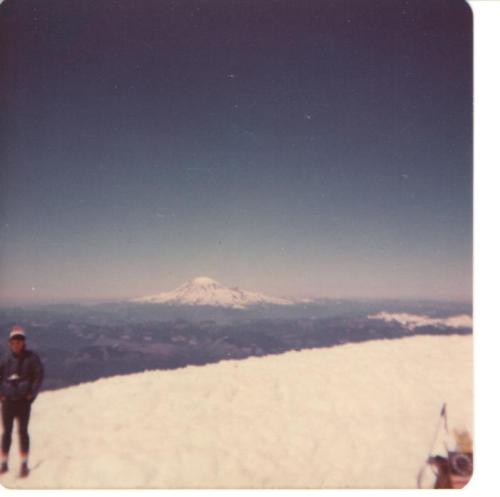
The view of Mount Saint Helens from the summit of Mount Adams on July 4, 1976.

The view of Mount Saint Helens from the summit of Mount Adams on July 4, 1976.

On the 200th anniversary of our country’s birth my cousin Dale and I joined one of the last mass climbs of Mount Adams in south-central Washington. I left from work on the Friday afternoon, drove to Yakima to pick him up, and we went to a campground outside Trout Lake to spend the night. Of course the excitement and the noise of all the other campers kept us awake all night. I don’t remember getting any sleep at all.

We were rousted out for the climb around 3:00 in the morning. We received some orientation and instructions and lined up to begin the climb. One of the instructions was to stay in line and not to pass those ahead of us. We were young and strong. Many of those ahead of us were neither, so the temptation  to violate that rule was strong.

We reached tree-line just before dawn, and that morning provided one of the most spectacular views I will ever see. We watched the ghostly pale peak of Mount Saint Helens emerge from the night, turning raspberry pink, then dazzling white. Before it erupted, Saint Helens was nearly perfectly symmetrical. As we strapped on our crampons and struggled to keep our places in line, we watched Mount Saint Helens in the distance, a graceful and beautiful mountain that later proved to be powerful and dangerous. Continue reading

Fu-Go, or How Geologists Fought off the Japanese Attack on North America, although the Threat Remains

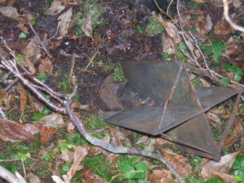
The tail of an unexploded Japanese balloon bomb protrudes above the mossy forest floor near Lumy, British Columbia.

The tail of an unexploded Japanese balloon bomb protrudes above the mossy forest floor near Lumby, British Columbia. This photograph is courtesy of Infonews.ca, which published a story about the bomb on October 10, 2014.

On November 3, 1944, the Imperial Japanese Army attacked North America, and they did it from three Honshu beachheads. It was on that date that the first of some 9,000 balloons, fitted with incendiary and high explosive bombs on a three-day timer, were lofted into the recently-discovered jet stream. The innovative form of aggression spread dangerous explosives across a huge swath of North American territory, from Alaska to Mexico, from the Pacific Coast to Detroit, Michigan. Fewer than 250 of these balloons have been accounted for, although an estimated 1,ooo balloons may have made it across the Pacific. While most of the 9,000 probably failed to reach American shores, those that made the crossing and went undiscovered might still pose risks to the unsuspecting.

Foresters working near Lumby, British Columbia, made the most recent discovery of unexploded Japanese bombs in October of last year. Hikers and people who work in wild places should be wary of undiscovered explosives from these balloons.

When Japanese balloon bombs, known as Fu-Go to their makers, first began to arrive in America, authorities mistakenly thought that the devices were being launched from submarines surfacing near our coasts or that they had been built in Prisoner-of-War camps along the coast. Continue reading

All the Warning We’ll Get

The Saddle Mountain Fault scenario envisions an 87-mile long failure of the fault.

The Saddle Mountain Fault scenario envisions an 87-mile long failure of the fault.

There was a small earthquake centered on Frenchman Hill one day around 1972. When an earthquake scientist from the University of Washington called Othello High School to look for a reliable  student to tend to a helicorder they were setting up at the epicenter, they ended up talking to my mother, the counselor. I was 16, and I had just gotten my driver’s license. She told them she had a perfect match for them.

So my second job off the home place (the first one was changing sprinklers for my neighbor) was visiting a tiny trailer parked next to a plowed field overlooking the Lower Crab Creek valley and the ancient massive slide on the north face of Saddle Mountain. Six seismographs fed streams of data to a series of heated needles that recorded every tremble of the earth around the trailer. I had to changed the waxed paper they burned their message onto once a day and then put in a phone call to Colorado to calibrate the clock with the National Bureau of Standards.

Although I didn’t know it at the time, this must have been a heady period for earthquake scientists in the Northwest. Endorsement of the theory of plate tectonics was in its infancy. Continue reading

Pahto

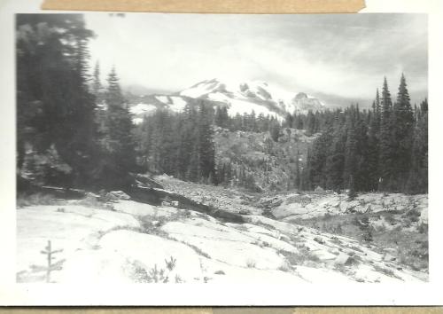
Mount Adams early in 1958, viewed from the foothills above Glenwood. Photograph by Walt Danielson.

Mount Adams early in 1958, viewed from the foothills above Glenwood. Photograph by Walt Danielson.

I climbed Mount Adams for the first time in 1957, when I was a year old. I had help. My parents corralled all six youngsters and, in caravan with my grandparents, they drove the axle-shattering dirt roads to Bird Creek Meadows, just below snowline on the shoulders of the great peak.  As proof of this visit, I offer the following pose, the portrait of an outdoors man as a very young man.

My father and I rest on a sandy bank at Bird Creek Meadows in 1957, when I was a year old.

My father and I rest on a rock on a sandy bank at Bird Creek Meadows in 1957, when I was a year old.

Although my current home lies much closer to Mount Baker, old Mount Adams has always held a dearer place in my heart. It’s prominence is due to the overwhelming presence it has in Glenwood, where my family arrived in 1882 as a band of uprooted Germans. My great-grandfather cleared a forested meadow and planted hay. His farm prospered and he gained prominence in his community, Continue reading

Landslide

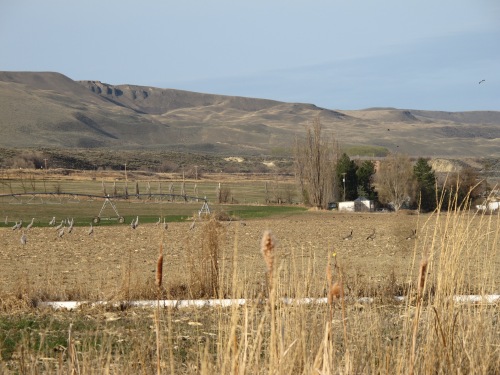
Sandhill cranes frolic in the fields of the Danielson farm, with the Saddle Mountain cliffs looming over it. Photograph by Phyllis Danielson.

Sandhill cranes frolic in the fields of the Danielson farm, with the Saddle Mountain cliffs looming over it. Photograph by Phyllis Danielson.

The communities of Oso and Darrington were devastated by the recent landslide, in which around fifty houses and more than thirty people were annihilated in the space of a couple of minutes. It will be a long time before life can return to anything like it used to be, with Darrington’s main artery to the rest of the world cut off. Now commuters from Darrington have to head north, past our Sauk River cabin, to get to their jobs, shops and supplies. It takes a lot of time and gas. My son’s scout troop raised cash and supplies that we took to Darrington last weekend, and I’ve been watching the news about the landslide daily.

Pictures of the Oso landslide reminded me very much of the landslide my family and I used to climb around on when I was a kid. One of our favorite hikes was to the cliffs at the top of Saddle Mountain, where you can climb down to a ledge where sandstone exposures have been carved by the winds and graffito-ed by generations of local visitors. Continue reading

Then & Now

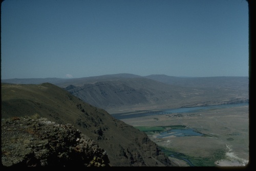
I published this photograph of the Lower Crab Creek Valley as viewed from the Taunton townsite in “Another Flood.” On a recent visit to the same spot I took the following photograph.

This summer I took a hurried trip through Eastern Washington, photographing sites I have written about. In this article I try to post old photographs alongside more recent ones. In some cases I have also provided views of places previously mentioned in my posts, although no older photographs are available to compare them to.

A view of the Lower Crab Creek Valley in 2012, more than fifty years after the previous photograph was taken, reveals the changing ecology of the formerly arid landscape. Irrigation and invasive species have radically altered the local habitat.

There is definitely an article to be written concerning the environmental changes that have taken place in the Lower Crab Creek Valley over Continue reading

Legends of the Ice Cave

Beneath this towering cliff and rubble fallen from it lie the remains of the Saddle Mountain Ice Cave.

There has been a fair amount of mystery concerning the Saddle Mountain Ice Cave. Even today you’ll find inquiries about it on internet chat sites. Over the years, locals disagreed on lots of points concerning this phenomenon. Some said it was a natural cavern, a huge chamber full of glittering perpetual ice. Others said it wasn’t really anything more than a big root cellar where people kept chunks of ice they would cut out of Crab Creek in the wintertime. Some people even doubt its existence. But it’s there.

Virtually all that’s left of the Ice Cave is a pile of old timbers and the remains of the massive wooden doorframe.

The Ice Cave is about four miles west of the end of the paving on the old Corfu Highway after you leave Smyrna, around eight miles from Beverly. It’s difficult to spot the remains from the roadway, so look for a large alkali clearing in front of it and a huge slope of tumbled rock flanking its other three sides. Continue reading

The Far Side of the City

That summer of 1981 I became familiar with urban poverty. By far, most of the families I encountered in Ardoyne relied on a government check, the Dole, to get by. How they managed to make the money stretch to pay their rent and what they called their rates (utilities) and taxes, I couldn’t imagine. Not to mention the money they spent on food, often at a chippie, which is what a fish and chip van was called. Sometimes they’d buy a curry from the truck that sat near the shops, but other times hunger drove them to serve their children “chip buddies.” This consisted of two slices of buttered white bread with French fried potatoes laid between them. Carbohydrate delight. Of course there always seemed enough money to pay for pints at the Shamrock and other social clubs.

I knew a woman from the college I’d attended in Spokane who had married a man from Belfast, and at one point that summer I contacted her for a friendly visit. She took me on a walking tour downtown and introduced me to her brother-in-law, who shared the opposite side of their huge semi-detached house on some private acreage to the south of the city. John was a bachelor, trained as a geologist, and comfortably situated after years of oil work in the Middle East. He was delighted to meet Sally’s college friends (I discovered that one of my dorm brothers had previously visited him), and he invited me to come to his house for dinner sometime when I wanted a break from the inner city.

My dinner with John was one of the most unusual events of that year, an evening of surprises. Continue reading

Treasure on the Mountain

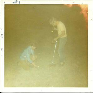
Too excited to wait for daylight, we began searching the wagon road in the early dark of an October night.

Joe and I had a plan one night in 1970. I had scraped together wages from a variety of odd jobs and mailed off for a Heathkit metal detector kit. My brother Arnold agreed to put it together for me: he always was an electronics whiz. Now it was done, and Joe and I had a plan. We threw some matches, water, weiners,  bread, pop and cookies into a couple of backpacks, tied on some sleeping bags, and I took a shovel out of the garage. Then, with the metal detector slung over a shoulder we set off up the road in the late afternoon.

The idea hatched a few weeks earlier when my Uncle Luke had piled us into the back of his Ford Econoline pickup to drive up to the cliffs. As we ground our way up the primitive dirt track we kept crossing wide ditch-like ruts leading off into the sagebrush, but we were too high up for irrigation. At the summit of the pass we stopped for a breather next to a small cairn of rounded basalt stones. There were several of those ditches leading through the gap, and my dad told me they were the ruts of a wagon road. As the ruts wore too deep into the powdery earth, succeeding travelers would break new trail parallel to the older ruts. The whole north face was interlaced with wagon trails, twisted into switchbacks. We scrambled back into the pickup to continue our trip and a low flying private plane buzzed us, sneaking over the gap in a shortcut across the forbidden airspace of the Hanford Reservation. Continue reading